Thursday, October 30, 2014

Mongaup Pond Campground New York

We realized as the leaves were turning, we were going to need to dump the camper before we could winterize it. Unfortunately, there are no easy dump stations around so we headed upstate New York to the Catskills for a quick weekend away and a final camping weekend for our camper. We chose Mongaup Pond.


We barely backed the camper into site #112 when the locals came to visit. Apparently we are on a daily visitation route since they came back at the same time both nights.


They stayed for maybe about half an hour, especially when we started feeding them. We just gave them one slice of bread just to thank them for visiting. I'm sure the regular visitors feed them constantly. They were fat!!


Kay with her band of quackers.


There was a male duck in the group who was the dominant male. When we fed one of his group members instead of him, he angrily bit their tail feathers, even though it was our fault that we fed that duck. We often threw a piece to the member who was farthest away just to make sure they got their share. The dominant male would take food right out of your hand if you let him. The bravest I got was to drop a piece an inch or two from the air and have him catch it.


Random pretty leaf.

A nice view of our camper and camp site with the fall trees in nice color.

Our little friends eventually got tired of us and flew back into the pond and swam away. They disappeared in seconds.


 A nice roaring fire.

The sun shed a little bit more evening light on the trees across the lake giving them an electric glow of orange.

Electric glow of last rays of sunlight while a random canoe passes by.

Last rays of sun.

Moonlight reflecting on the water. Play with the aperture, speed and ISO and you get all kinds of different results.

 I turned down the ISO and sped up the shutter and you can see more accurately how dark it is on the lake. I still could not get the details of the moon in the photo. It shows up as a "dark sun" when it's really a bright moon.
 
View of the trees over our camper:


Trees at our campsite.

Trees at our campsite.

Another view of the camper and the campsite. We could not see or hear any other camper at this time of year, but even with the campground full, we would expect this site to be pretty quiet and private.


View of our campsite from between ours and the next campsite.

This is a view of the lake from our campsite. You can barely see into the campsite next door because there is so much vegetation in the way.

View of the bathrooms from the site next to us. This would have also been a good site but we didn't need to be so close to the neighbors. I thought the bathrooms would be pit toilets but they are regular flush toilets. They don't have hot water or paper towels though so it's cold. The campground had to close soon after we were there because the temperature starts dropping below 32 degrees and these bathrooms need to be winterized.

This is a shot of the campsite next door (site #111 or 110?). It also would have been nice but 

A view of our campsite from the camp road. While the main campground roads are paved, the sites are not and they are pretty warn in. Also, there are a lot of trees so you may have trouble backing a big rig in to one of these sites. A fifth wheel parked a couple sites down from us and I think it took them an hour to back in to the spot. I wasn't sure they were going to make it but somehow they did. We had trouble just getting our relatively small rig in this campsite.

View of our campground loop. The spot straight ahead is where the fifth wheel parked later in the day.

Random trees overhead.

Random other campsite on our loop. Some of the sites had steep driveways and trees preventing long rigs from getting in them.

Random campsites in the neighborhood. Some campsites especially along the lake edge were very nice but other sites were just plain yucky or odd. There was a huge variation. This site does not look well used because you couldn't even see a "driveway" where somebody parked. Sometimes the spaces weren't even flat enough that you could figure out where to put a tent. Perhaps a backpacker or a cross-country bike might use a spot like this, but certainly not an RV, 2 cars or a large tent.

Site #98 doesn't look too bad either.

Another site.

Another campsite.

There was a handicap access fishing deck along the lake. This time of year, we had it all to ourselves.

A walk along the road near loops A, B and C and the campground entrance.

Walking to the other side of the campground to loops A, B and C.

The campsites on loops A, B and C were closer together, less used, and less desirable in general. The only plus was that there was nobody around so you could be as noisy as you wanted. There were 2 people camping in this area.

Site #92 would show on a map as being near the water, but it's quite a hike to the water and you can't entirely see it from your campsite. As a bonus, the people on the opposite side of the lake where we were are not going to see tent after tent on the other side of the lake.

Some red trees on fire across the lake. The sky was overcast and came out completely washed out white. I'm not sure why other photographers claim they love cloudy and overcast skies.

Furry caterpillar.

The bottle caps stuck to this table gave us an indication of what this campground may be like during the busy season.

Sites at this loop were very close together. You can see about 6 or more sites from this spot. If it was a busy weekend, there would probably be wall to wall tents in site. Many of these sites were too small for RVs and meant mostly for small tents. Barely enough room for a car and a tent. Most sites were covered with grass and no tire tracks indicating that they were not well used.

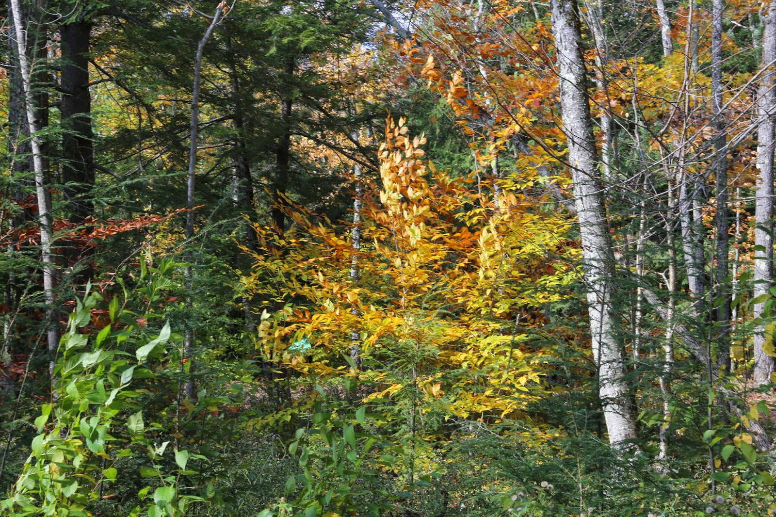
There were some brightly colored leaves in the forest. I don't know what kind of tree this is.


Sunday, August 24, 2014

Mount Washington Auto Road, White Mountains, NH, August 2014

This August during our camping trip, we drove the Mount Washington auto road for the second time. Last year, the mountain was angry. The wind was so strong, husband could barely stand up in it. He walked out to a point and on the way back, facing into the wind, he lost his breath. I had on thermal underwear, pants, socks, a hat, scarf, sweater, coat, and boots and I was still freezing in the wind. 40 degrees with a 40 mile per hour wind (I'm guessing) and boy it was cold. This year, the mountain was a kitten. We drove up and I had on nothing but a light sweater just to keep a little nip off me. Husband was fine in shorts.

I forgot how expensive the trip up the mountain is. But if you take the train, double the driving price -- per person! Not quite sure why it's *that* expensive...
  Not far up the road, you get to see views peeking out. You feel like you are already high up compared to everything below, even when you are only a fraction of the way into the trip.
 Clouds passing the road up ahead.
 There is one parking lot about 1-2 miles into the 8 mile drive where you can pull over and take your first photos of the view below.
Here, you are still within the trees. The road goes another 6 or so miles past this point. Keep going!

 Husband admiring the view.
 Jess admiring the view.


 Next viewpoint is another couple miles up the road. Again, you feel you are on top of the world as you see the clouds forming around you and below you. How can we be only half way??


 I just love these photos!


 Jess is very excited about our trip!!


 I love how the road is above the clouds.

Our truck goes everywhere! HAH!


 It looks like the road just disappears into nowhere.
 At this viewpoint, we can see below to the prior viewpoint where we stopped earlier.


 I love in this photo, it looks like the road just ends into a pile of clouds.
 Admiring the view below.

Jess's great idea to have us jump in unison. Yay!

The alpine zone! We are well above treeline where not much grows.

I always read about these trails (though I'm not nearly brave enough to try to hike them from the bottom up to the top). It's interesting to see what they look like in person. When you are at the top of the mountain, you can see the various trails around you as if they were laid out on the map in front of you. In reality, even though you can see tiny people hiking below and the trail looks like it's "right there", it's not really right there. It's quite a hike to get there, there just aren't any trees in the way.

A few alpine flowers growing in the rocks at 6000+ feet elevation.

Walking a short way on one of the trails. We left the truck parked at the parking spot. Last time we were here, the wind was blowing 40 miles an hour. Only husband was brave enough to walk down the path about 1/10th of a mile. I stayed in the car and changed into my thermals and the wind was so strong, it shook the truck. This time, you can see there's barely a breeze and a light sweater or jacket is all that you might need.

Dear hiker: please follow these rocks. There ain't nothing else to follow.


Some geology up at the top of the whites.

A big chunk of what appears to be quartz in the scree at the top.


This is one of those great photos where you can see the trail below you but yet it's nowhere actually near you. The fact that you can see it is quite deceiving.


Mica embedded into the rocks everywhere!


Giddiness at the summit. The best time to snap a photo is just before the next cog railway train. Everybody is waiting to get on but nobody has gotten off yet. Immediately after that, the line was 20 people long.


The AT crosses Mount Washington at the peak. But the funny thing is, at the top of the mountain is a railroad, a gift shop, a historic house, an observatory, and a bunch of equipment, buildings and parking lots for the hoards of tourists who took the easy way up. If you are hiking the AT, it's not quite clear where the AT comes from or goes to. 

The view from the parking lot. Even that is fabulous!


I had to take a photo of the "no hitchhiking" sign because last time a hitchhiker asked for a ride. He was a jogger from Maryland who thought he could "beat a record" for running the whites. He got lost, never made it to the second mountain, had no food, no water, and no money. While we were driving him back to the bottom, his sugar levels started to crash and he felt sick. Oy!!

The Tuckerman Ravine trail starts right next to the parking lot. 


You almost need the people in the picture to provide the perspective. The trail is mostly just a bunch of rocks to scramble over and around, and it quickly drops in distance and elevation away from the parking lot area.

The weather really cooperated. Last year, this was nothing but clouds and you couldn't even see there was a mountain in the distance.

This trail appears to go over the tops of the mountains so it may be the AT and the "Presidential Traverse". It's a little bit too rough for me to want to hike it. 

The clouds gave way to a great view. Now you can see the trail going over the mountain and the far away mountains in the distance.

Jess admiring the view.

There was a strange pile of rocks by the parking lot (which is just out of view). They are dated and have initials painted onto them. Some of them seem to be in memory of loved ones.

More clouds gave way to open up this seldom seen (at least seldom seen by me) view of the ski resort area below.