I forgot how expensive the trip up the mountain is. But if you take the train, double the driving price -- per person! Not quite sure why it's *that* expensive...


Husband admiring the view.


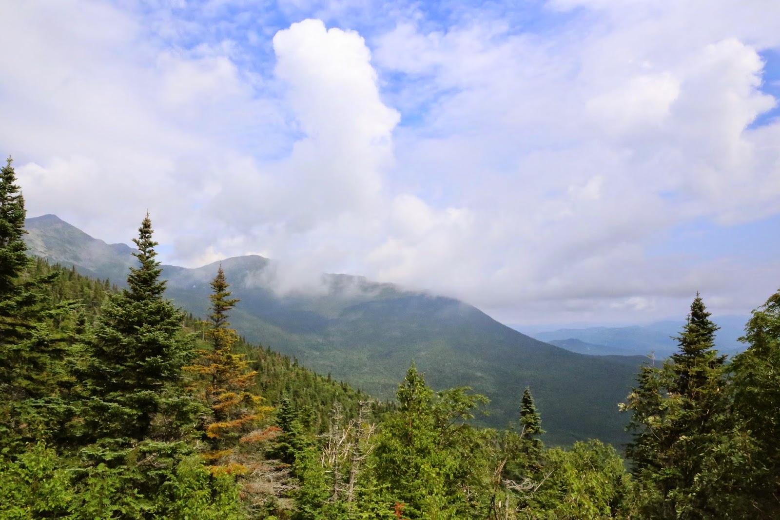
Next viewpoint is another couple miles up the road. Again, you feel you are on top of the world as you see the clouds forming around you and below you. How can we be only half way??


I just love these photos!


Jess is very excited about our trip!!


I love how the road is above the clouds.

Our truck goes everywhere! HAH!


It looks like the road just disappears into nowhere.


I love in this photo, it looks like the road just ends into a pile of clouds.


Jess's great idea to have us jump in unison. Yay!

The alpine zone! We are well above treeline where not much grows.

I always read about these trails (though I'm not nearly brave enough to try to hike them from the bottom up to the top). It's interesting to see what they look like in person. When you are at the top of the mountain, you can see the various trails around you as if they were laid out on the map in front of you. In reality, even though you can see tiny people hiking below and the trail looks like it's "right there", it's not really right there. It's quite a hike to get there, there just aren't any trees in the way.

A few alpine flowers growing in the rocks at 6000+ feet elevation.

Walking a short way on one of the trails. We left the truck parked at the parking spot. Last time we were here, the wind was blowing 40 miles an hour. Only husband was brave enough to walk down the path about 1/10th of a mile. I stayed in the car and changed into my thermals and the wind was so strong, it shook the truck. This time, you can see there's barely a breeze and a light sweater or jacket is all that you might need.

Dear hiker: please follow these rocks. There ain't nothing else to follow.


Some geology up at the top of the whites.

A big chunk of what appears to be quartz in the scree at the top.


This is one of those great photos where you can see the trail below you but yet it's nowhere actually near you. The fact that you can see it is quite deceiving.


Mica embedded into the rocks everywhere!


Giddiness at the summit. The best time to snap a photo is just before the next cog railway train. Everybody is waiting to get on but nobody has gotten off yet. Immediately after that, the line was 20 people long.


The AT crosses Mount Washington at the peak. But the funny thing is, at the top of the mountain is a railroad, a gift shop, a historic house, an observatory, and a bunch of equipment, buildings and parking lots for the hoards of tourists who took the easy way up. If you are hiking the AT, it's not quite clear where the AT comes from or goes to.

The view from the parking lot. Even that is fabulous!


I had to take a photo of the "no hitchhiking" sign because last time a hitchhiker asked for a ride. He was a jogger from Maryland who thought he could "beat a record" for running the whites. He got lost, never made it to the second mountain, had no food, no water, and no money. While we were driving him back to the bottom, his sugar levels started to crash and he felt sick. Oy!!

The Tuckerman Ravine trail starts right next to the parking lot.


You almost need the people in the picture to provide the perspective. The trail is mostly just a bunch of rocks to scramble over and around, and it quickly drops in distance and elevation away from the parking lot area.

The weather really cooperated. Last year, this was nothing but clouds and you couldn't even see there was a mountain in the distance.

This trail appears to go over the tops of the mountains so it may be the AT and the "Presidential Traverse". It's a little bit too rough for me to want to hike it.

The clouds gave way to a great view. Now you can see the trail going over the mountain and the far away mountains in the distance.

Jess admiring the view.

There was a strange pile of rocks by the parking lot (which is just out of view). They are dated and have initials painted onto them. Some of them seem to be in memory of loved ones.

More clouds gave way to open up this seldom seen (at least seldom seen by me) view of the ski resort area below.

No comments:
Post a Comment